


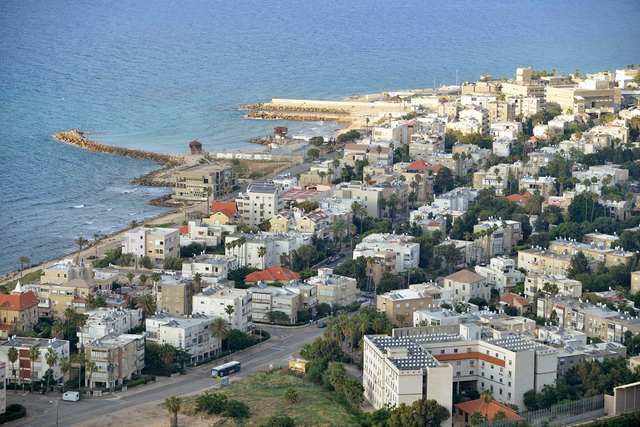
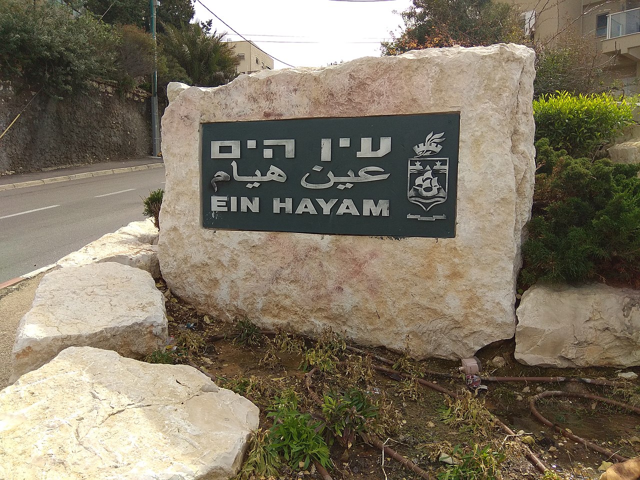
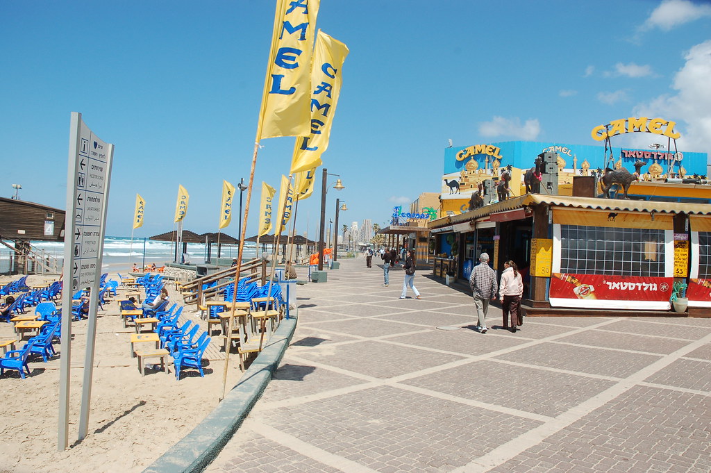
Covering 9.33 sq. km. Western Haifa constitutes 14.7% of Haifa’s area. The population of 39,720 residents makes up 14.2% of the city’s population. This area stretches alongside the Mediterranean Sea bordered by the beaches and the slope of Mount Carmel. The area’s main points of interest are ancient Haifa sites including Tel Shikmona and Elijah’s Cave; the cable car from Stella Maris to the beach, the sea side promenade and beaches. Neighborhoods include Bat Galim, where the Rambam Medical Center and Medical School are located, Kiryat Eliezer, Kiryat Shprinzak, Ein Hayam, Sha’ar Ha’aliya and Neve David. The southern part of this area, which is the southern outskirts of Haifa, includes the southern transportation depot for buses and trains (Merkazit Hof Hacarmel), MATAM – Science-based Industry Park, the future bio-tech research center, the Haifa Conference Center, and shopping and recreation areas. These include the southern beaches (Dado and Zamir), Haifa Mall (Kanyon Haifa), Castra Mall and Art Center, Sportan Country Club, Leonardo Hotel and the Sami Ofer Stadium.
Bat-Galim and Kiryat Eliezer have a combined population of 18,700 – forty-one percent of them are new immigrants. Bat Galim was the first point of Jewish settlement in modern Haifa, established in the 1920’s. After the State of Israel was established, housing for demobilized soldiers was built in Kiryat Eliezer, between the years 1951-1954, when long, multiple-entrance, three- to four-story public housing projects were built.
The following public institutions, facilities and sites can be found in these neighborhoods:
- Aliya Elementary School (Map)
- Dror Elementary School (Map)
- Yavnieli Elementary School (Map)
- Shalva Elementary School (Map)
- Henrietta Szold Special Education Elementary School (Map)
- Reut School of the Arts and Mifal Hapais Community Center (Map)
- Ironi Aleph Junior-High and High School(Map)
- Arab Orthodox High School (Map)
- Mazor Technological High School(Map)
- Shoham Technological High School (Map)
- Tzur Yam Navy Technical High School (Map)
- Bat Galim Community Center (Map)
- Public libraries (Bat Galim (Map) and Kiryat Eliezer)
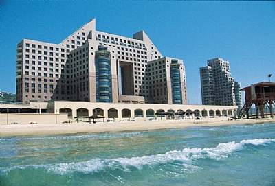
- Rambam Medical Center, Medical and Nursing Schools (Map)
- Lin Medical Center belonging to Kupat Cholim Clalit (Map)
- Magen David Adom emergency medicine and ambulance services center (Map)
- Family Health Center (Tipat Halav) (Map) National Maritime Museum (Map)
- Clandestine Immigration and Naval Museum (Map)
- Elijah’s Cave (Map)
- Stella-Maris cable car – bottom depot (Map)
- Bat Galim train station (Map)
- Beaches (Bat Galim (Map) and Hachof Hashaket (Map) (the silent beach) with separate hours for men and women)
- Maritime Educational Center (Map)
- Supermarkets – Mega in the City (Map), Shufersal Deal (Map), Keshet Ta’amim (Map)
- Aba Chushi student dorms (belonging to the Jewish Agency) and new immigrant information center
- Kassel student dorms (Map)
- Senior citizens clubs and day center
- Youth centers (Ganim and Ironi Aleph)
- Meyerhoff Square Shopping Center (Map)
- Unemployment center for professionals (Map)
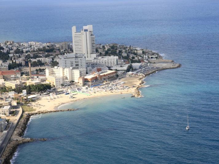
Hof Shikmona has 19,600 people living within its area – 38.6% of them are new immigrants.
This district includes the following neighborhoods from North to South; Ein Hayam, Kiryat Shprinzak, Sha’ar Ha’aliya and Neve David. Sha’ar Ha’aliya and Neve David were originally established as transit camps for new immigrants (ma’abarot), in the 40’s and 50’s when Haifa was one of the main points of entry for new immigrants. Later, permanent housing was built and they became part of Haifa’s neighborhood network. Kiryat Shprinzak was established between the years 1951-1954 and is also a site of many long, multiple-entrance three- to four-story public housing projects.
The following facilities can be found in this area:
- Ramot Elementary School (Map)
- Hofit Elementary School (Map)
- Nirim Elementary School (Map)
- Ein Hayam Elementary School (Map)
- Ofer Special Education Elementary School (Map)
- Ganigar Elementary School for children with special needs (Map)
- Almasar Special Education Elementary School (Map)
- Ibn Gvirol Special Education Religious Junior High School (Map)
- Ganigar Special Education Junior High School (Map)
- Beit Maya center for children at risk (Map)
- Beit Fanny Kaplan (Map) and Neve David (Map) community centers
- Municipal libraries (Neve David (Map) and Kiryat Shprinzak (Map))
- Oceanographic Research Center (Map)
- Tel Shikmona archeological site (Map)
- Supermarkets – Mega in the City (Map), Yesh B’Schunah (Map), Shufersal Deal (Map)
- Ramat Hanasi Shopping Center (Map)
- Neve David youth club
- Haifa Skate Park (Map)
- Senior citizens centers and housing
- Family Health Center (Tipat Halav) (Map)
- Ministry of Defense rehabilitation center
- Military rehabilitation center.
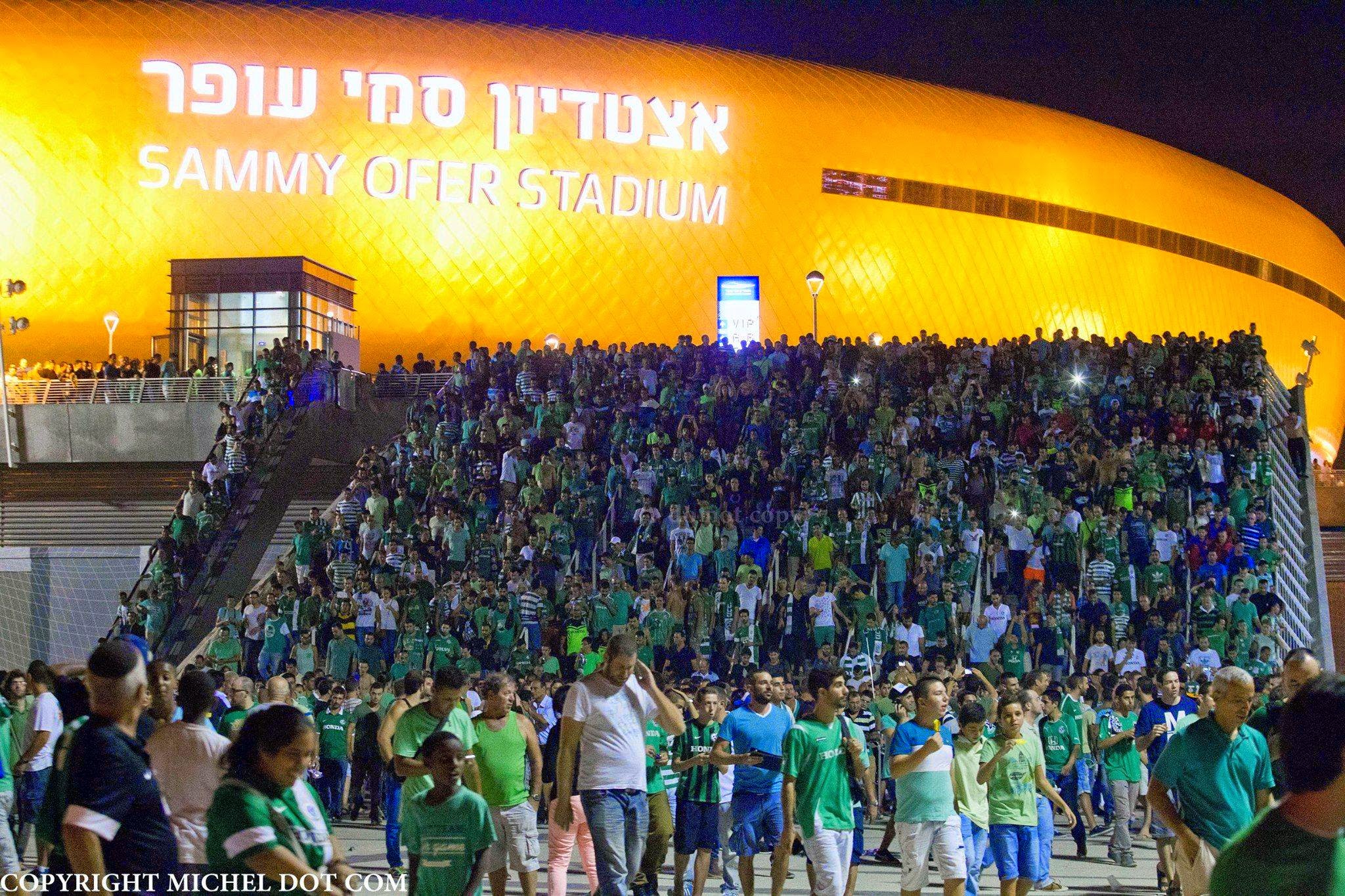
The South Beach area serves as the city’s southern gate on the coastal road (Route 2), the Old Road (Route 4) and by railway. The area is one of Haifa’s main transportation hubs, connecting the south and the center of the country with the Carmel/Ahuza ridge area and the rest of Haifa. The existing MATAM Science-based Industry Park, housing many international companies, is under expansion. There are plans for a new biotech research center as well as Haifa’s new international stadium and new housing and hotel projects in this area. The Carmel tunnel, connecting this district with the Grand Canyon/Neve Sha’anan area and the Northern Check Post vicinity, is also under construction.
Currently the following can be found in this district:
- Public beaches (Carmel (Map), Zamir (Map), and Dado (Map))
- Leonardo Hotel (Map)
- MATAM Science-based Industry Park (Map)
- Sami Ofer Stadium (Map)
- Kanyon Haifa Mall (Azrieli Haifa) (Map)
- Castra Mall (Map)
- Congress Center (Map)
- Hof Hacarmel train station (Map)
- Merkazit Hof Hacarmel bus depot (Map)
- Supermarket – Stop Market (Map), and Shufersal Deal (Map)
- Youth Hostel
- Sportan Country Club (Map)
- Tennis, bowls and soccer courts
- Cable Television Center
- Israel Electric Company main offices
- Cemeteries (Map)