


This district has an area of 5.31 sq. km. – 8.3% of Haifa’s area. The population of 36,680 makes up 13.2% of Haifa’s population. Situated in the northern part of Haifa, and separated from the other parts of the city by the Check Post industrial zone and Haifa airport, it is physically connected to the Krayot area (Motzkin, Yam and Bialik). These neighborhoods were established in the 1930’s as suburbs in the outskirts of the industrial zone. In 1951, they officially became part of municipal Haifa. The railroad divides between eastern and western Kiryat Hayim and between Kiryat Shmu’el and Kiryat Motzkin in the east. The train is part of the local, metropolitan and national transport system making transportation easy and comfortable.
Kiryat Shmu’el has 7,130 residents and was established in the 1930’s as a neighborhood for religious residents. Kiryat Shemu’el has enjoyed growth in the last decade, when many new housing projects were built. Young religious families are moving into the neighborhood and preserving the religious character of the place. Kiryat Shemu’el is closed to traffic on Shabbat and Jewish holidays. It is a good option for religious olim from the west who are seeking an exclusively religious neighborhood.
Public Institutions in Kiryat Shmu’el:
- Aharon Haro’eh Elementary School (National Religious) (Map)
- Beit Chana Elementary and High School for Girls (National Religious) (Map)
- Talmud Torah Habad Elementary School (National Religious) (Map)
- Netivot Moshe Elementary School (Independent – Charedi) (Map)
- Pirchei Aharon Municipal Yeshiva High-School – (Municipal High School Bet) (Map)
- Sha’anan College – religious teacher’s seminary (Map)
- Family Health Clinic (Tipat Halav) (Map)
- “Naharim” Rehabilitative Housing (Map)
- Emunah Day Care (Map)
- Supermarkets – Shufersal Deal (Map), Co-Op Shop (Map)
- Community Center (Map)
- Kiryat Shemu’el Municipal Library (Map)
Kiryat Hayim West has 9,500 residents. It was established with the waves of immigration in the early years of Israel on lands belonging to the JNF. Kiryat Hayim is bordered by the sea on the west, Kiryat Yam on the north and Kiryat Shemu’el and Kiryat Hayim on the east.
During the immigration waves of the 90’s many new immigrant families were absorbed in the neighborhood. They now constitute 27.9% of the population. Kiryat Hayim East and West share the same high schools but community centers are active in both areas.
Public facilities in Kiryat Hayim West:
- Gordon Elementary School (Map)
- Degania Elementary School (Map)
- Regavim Junior-High School (special-needs school) (Map)
- Beit Heine Community Center and Library (Map)
- Charna Youth Center (Map)
- Senior Citizens Day Center
- Supermarket – Makhsanei Lahav (Map)
- Family Health Clinic (Tipat Halav) (Map)
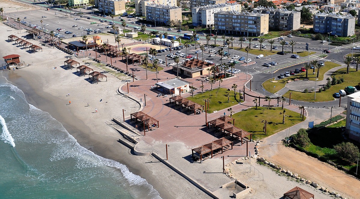
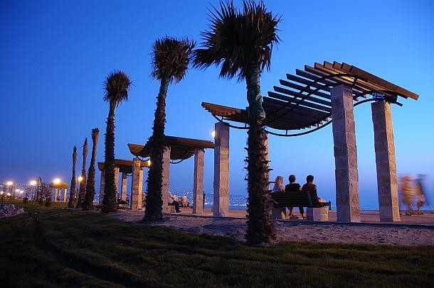
- Public supervised beach (Map)
- Public park
- Beit P’nina senior citizens home (Map)
Kiryat Hayim East has 19,000 residents and was established in the beginning of the 1930’s as a workers’ neighborhood composed of single family houses. This profile was maintained until the 1960’s when new public housing projects were built. For the past few decades Kiryat Hayim East is undergoing renewal characterized by increasing the density of housing, either by adding new buildings or by demolishing old ones and replacing them with apartment projects.
Public facilities in Kiryat Hayim East:
- Arlozorov Elementary School (Map)
- Meginim Elementary School (Map)
- Learning Enhancement Center (Map)
- Amal College (Map)
- Beit Nagler Community Center and Municipal Library (Map)
- Community Pais Center (Map)
- Community sports hall (Map)
- Senior citizens club
- Hostel for the elderly
- Beit Yatziv (Map) and Tzeitlin (Map) youth centers, Beit Ressler youth center
- Family Health Center (Tipat Halav) (Map)
- Yad Labanim house (Map)
- Hatzafon Theater (Map)
- Memorial Park (Gan Hazikaron)
- Zevulun police station (Map)
- Kiryat Hayim Train Station (Map)
- Supermarkets – Shufersal Deal (Map), Shufersal Express (Map)