


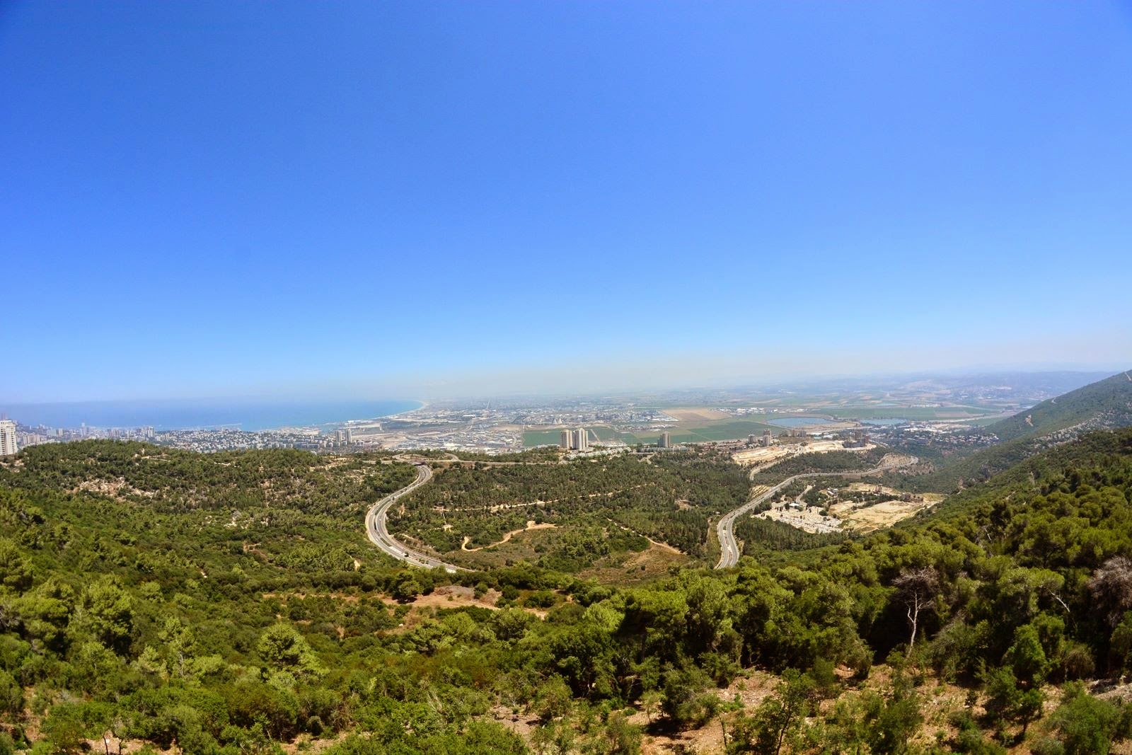
Covering 7.78 sq. km. the Carmel district constitutes 12.2% of Haifa’s area. The Carmel’s 48,780 residents make up 17.5% of the city’s population and make this the most populated quarter. Built along the ridge and higher slopes, this area started to develop towards the end of the 19th century. With new immigrants from Germany settling in the Central Carmel neighborhood in the 1930’s, the quarter then expanded outwards towards Ahuza and French Carmel. The area got a boost in the 1960’s, becoming one of Haifa’s main business districts. The development included the building of hotels, shopping centers, coffee shops and restaurants. The Haifa Auditorium, The Haifa Cinemateque, museums, parks and the Louis Promenade overlooking the Haifa bay were added along the years. The Carmel neighborhoods all attract olim from the west and olim can be found in most areas. The Carmel district includes three neighborhoods; Carmelia-Vardia, Central (Merkazi) and Western Carmel and Carmel Tzarfati (French).
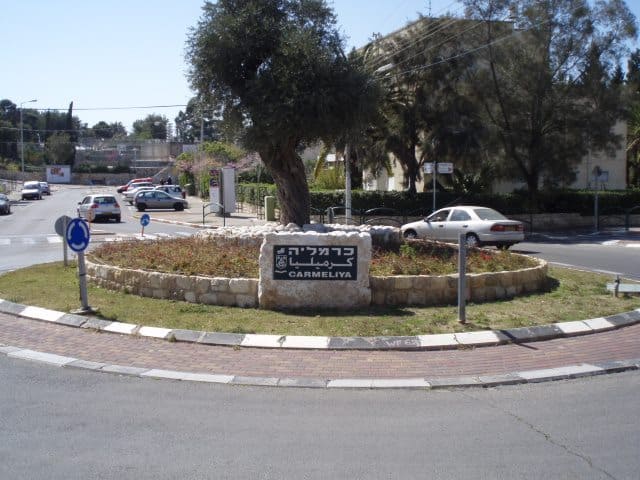
The Carmelia-Vardia neighborhoods includes Shambour and Carmelia on the western slope and Vardia on the eastern slope and has a population of around 15,200. Shambour was established in the 1950’s, Carmelia in the 1960’s and developed down the slope mainly with terraced houses. Vardia was established in the 1980’s as an up-scale community of largely single and semi-detached dwellings.
The following facilities can be found in these neighborhoods:
- Herzl Elementary School (Map)
- Yad Lebanim Community Center and library (Map)
- Family Health Center (Tipat Halav) (Map)
- Learning development center
- Vardia Center (Map)
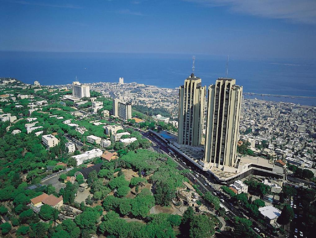
The Central and Western Carmel area has a population of 21,300 and is composed of a mixture of old and new buildings. A bustling commercial area, including coffee shops, restaurants and hotels can be found at the Carmel Center (Merkaz Hacarmel) along Moriah-Sderot Hanassi Boulevards and it spills into the adjacent streets and the Carmel ridge axis. The Bruce and Ruth Rappaport Art and Culture Center and Auditorium complex is the regional center for culture and music lovers. Among others, it hosts the Israeli Philharmonic Orchestra and The Haifa Symphony Orchestra. Right next door is the Cinematheque, with a variety of movies and related events and festivals. The area also contain the village of Kababir, a small Muslim enclave of Israeli citizens of the Ahmedi sect.
The following additional facilities and institutions can be found in this neighborhood:
- David Yelin Elementary School (Map)
- Ilanot Elementary School (Map)
- Hare’ali private Elementary and Junior High School (Map)
- Ahmedia Elementary School (Map)
- Ofakim-Ilanshil special education school (Map)
- WIZO municipal High School (Map)
- Chugim municipal High School (Map)
- Ironi Hey Municipal Junior High and High School (Map)
- Beit Miller center for technology and communication (Map)
- Yuval center for music and youth orchestras (Map)
- Elisha Hospital (Map)
- Beit Hecht Community Center (Map)
- Auditorium shopping center (Map)
- Hotels (Crowne Plaza, Dan Gardens, Carmela Boutique Hotel)
- The Haifa Zoo, Biological Institute and pre-historic museum (Map)
- Mane Katz Museum (Map)
- Gan Hayeled activity center for disabled children (Map)
- Senior citizens club and day center
- Senior citizens homes (Elisha Towers (Map), Vered Hacarmel (Map), Lev Hacarmel (Map), Ben Yehuda (Map), Ne’ot Hacarmel, Beit Yules (Map), Tif’eret Hacarmel (Map), Beit Ya’ara (Map) and Yefe Nof (Map))
- Maccabi sport center and swimming pool (Map)
- Municipal library (Map)
- Supermarkets – My Shufersal (Map), Mega in the City (Map)
- Family Health Clinic (Tipat Halav) (Map)
- The Foreign Ministry’s Carmel – Golda Meir International Training Center (Map)
- Gan Ha’em park and open air theatre (Map)
- The top station of the Carmelit (Haifa’s underground funicular railway) (Map) UNDER RENOVATIONS UNTIL FURTHER NOTICE
- Swiss Consulate (Map)
French Carmel (Carmel Tzarfati) has a population of 12,100, and it stretches from Merkaz Hacarmel along the Carmel ridge up to its end in Stella-Maris and sloping westward from the ridge. Some of this area dates back to the days before the State of Israel. Ramat Shaul was built in the late 1950’s and Ramat Hatishbi in the 1970’s; the building style in the area varies from low to high buildings depending on the period in which it was built.
The following facilities and institutions can be found in this neighborhood:
- Tchernichovsky Elementary School (Map)
- Gil Elementary School (special education) (Map)
- Leo Baeck Junior High and High School with adjacent sport center and swimming pool (Map)
- Beit Rutenberg Training Center (Map)
- Gordon Academic College (Map)
- The Krieger Performance Art Center in the Gaston Depaur Center (Map)
- Tikotin Japanese Art Museum (Map)
- Gan Hapsalim – Sculpture Garden (Map)
- Cloisters and Christian religious institutes (Map)
- Stella-Maris cable car top depot and the San Francisco Observatory (Map)
- The top entrance to the Ba’hai Gardens (Map)
- Maon Reut senior citizens home
- Hotels (Dan Carmel, Dan Panorama, Bay View Hotel, Hotel Beth Shalom)
- Panorama shopping center (Map)
- The Louis Promenade (Map)
- Beit Halochem rehabilitaion sport center (Map)
- Beit Meinz municipal library (Map)
- Family Health Clinic (Tipat Halav) (Map)
- Senior citizens club
- Beit Chana AKIM (organization for special needs children) Club
- Beit Burla – activity center for the deaf